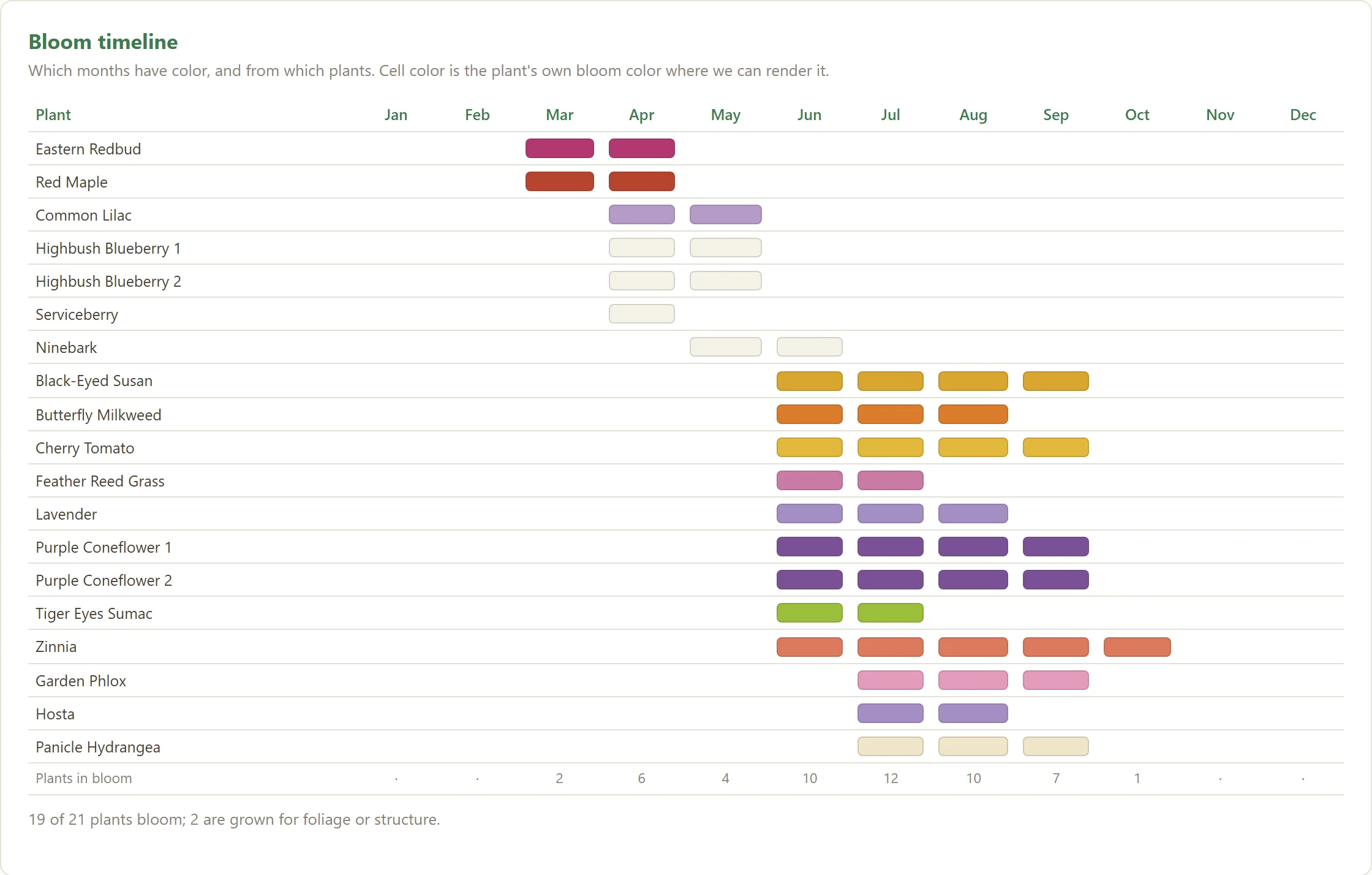
When the color comes — and when it leaves.
Scrub through the year and watch the garden light up: who's blooming in June, which corner goes scarlet in October, and the quiet weeks between. A bloom lens, a foliage lens, month by month.



Walk the yard with your iPhone and Dibble maps every plant to the inch. Then the good part: see what your garden is up to — when the color arrives, who's about to crowd whom, what's thirsty, how much of it is native — and show it off.
Dibble for iPhone is in final field testing — the App Store listing opens at launch.

Once every plant has a spot, the yard starts talking. Dibble turns your captures into the things you actually wonder about on a Sunday morning.
Scrub through the year and watch the garden light up: who's blooming in June, which corner goes scarlet in October, and the quiet weeks between. A bloom lens, a foliage lens, month by month.
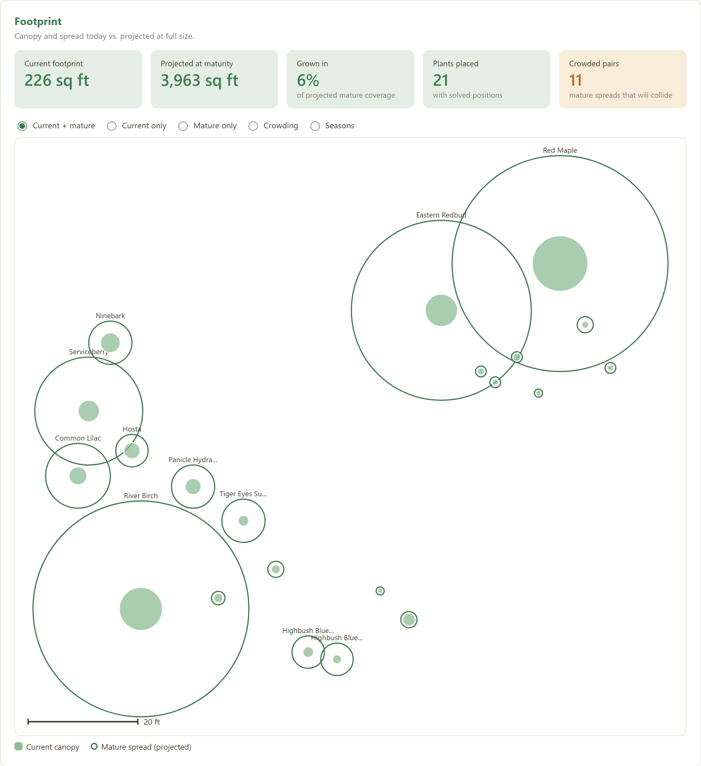
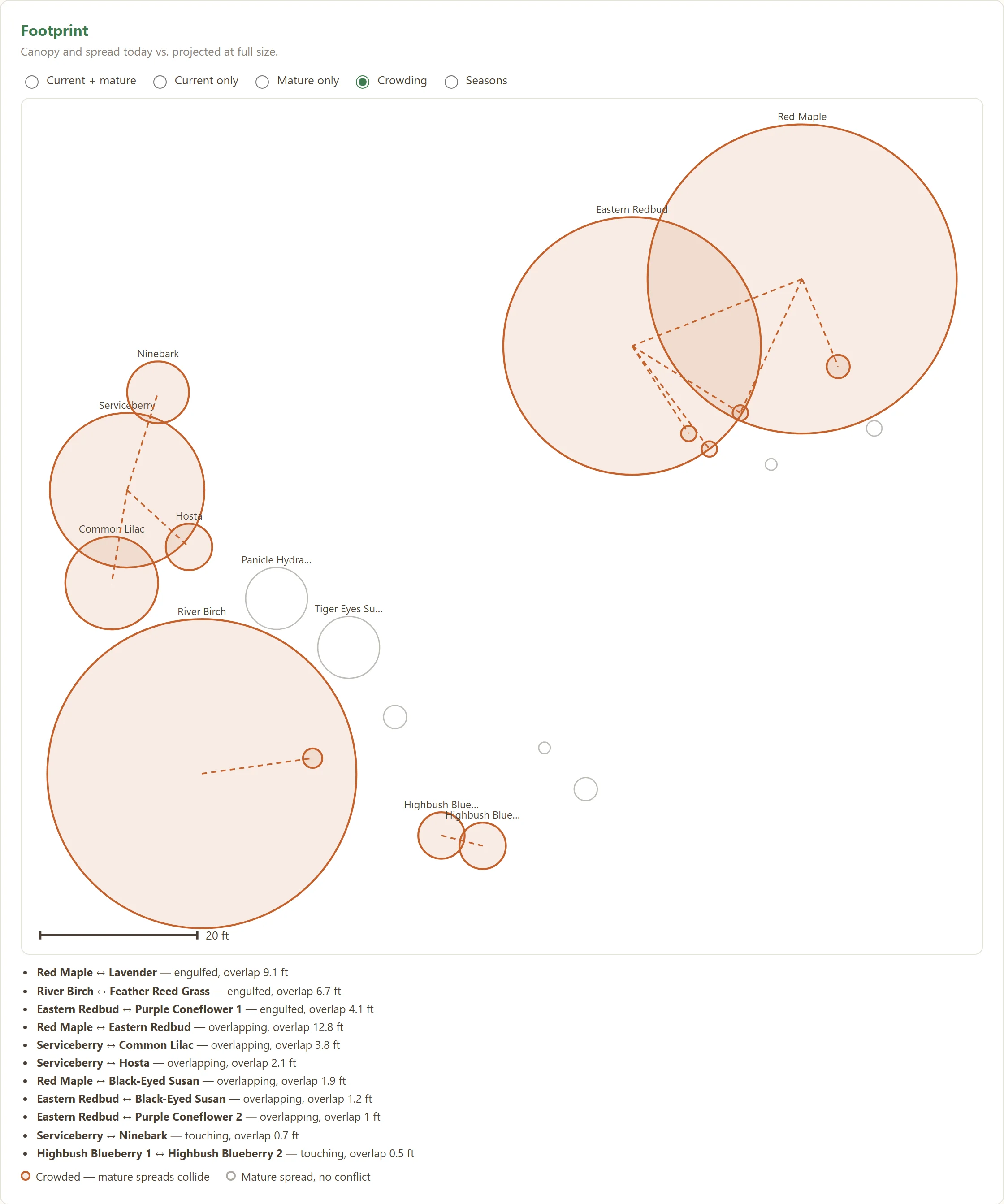
Every plant is drawn at today's size inside its full-grown spread. Where the rings will overlap, Dibble names the pair — so you move the hydrangea now, not in 2031.
The Water needs layer paints the map by appetite — low, moderate, high. Handy when you're planning a drip line, or talking yourself into another blueberry.

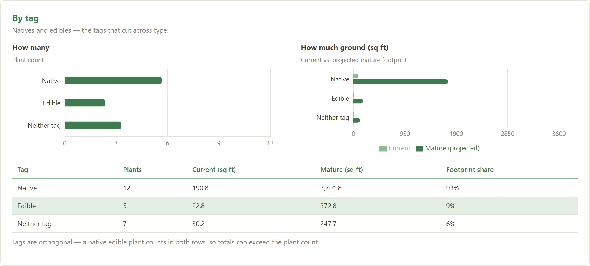
Six numbers on the Garden tab: canopy today and at full size, percent native, edibles, in bloom now and next month. The dashboard goes further — by plant type, by tag, by how much ground each one takes.

The photo from the day you captured it, the facts — each labeled tag, voice, or AI — and a mini-map of where its siblings live.

Care windows generated for your actual plants: prune, feed, divide, mulch. Tap done when it's done and the history stays with the garden. The Care due widget puts this week on your Home Screen.


You built this. Dibble gives you the numbers and the pictures to make other people want to.

At year's end Dibble hands you a card: plants added, months with something in bloom, and a cheerfully rough estimate of the CO₂ soaked up, the water saved versus lawn, and the native habitat you've built. Share it. Gloat a little.

Send a view-only web page of your garden — every plant, where it grows, when it blooms. No photos, no notes, and nobody can touch anything. Turn it off any time.
No survey gear, nothing to print. Just walk.
Aim at two fixed things you already own — a sprinkler head, a fence post. Everything is measured from them.
Aim the reticle at a plant, tap. Dibble records its spot to the inch and snaps a photo.
Talk, scan the nursery tag, or let AI look it up. Every AI-filled fact is labeled so you know what came from where.
Positions come from your iPhone's AR camera and LiDAR, measured against your own landmarks — inches, not the 10–30 ft slop of a GPS pin. Works offline in the yard; syncs when you're back inside.

Plants, photos, zone photos, and care history all live in your account, not just on the handset. Drop the phone in the pond, buy another, sign in with Apple or email, tap Restore — and every plant is back where you left it.

Mapping is free on every plan — every plant, every zone. Plans meter the monthly AI assists.
Map the whole yard, taste everything
A full season of steady gardening
For pros and serious collectors
Home and Pro are annual subscriptions purchased in the app — a garden's value spans a season, not a month. Final pricing is announced at App Store launch.
iPhone with iOS 17 or later. LiDAR (iPhone 12 Pro and later Pro models) gives the sharpest captures; every recent iPhone works.